
Enhancing Urban Building Modeling Accuracy with Drone Imagery and Ground Control Points Using SFM/ MVS Techniques
DOI:
https://doi.org/10.58564/IJSER.3.3.2024.227Keywords:
3D Building Models, UAV Image, Multi-view Stereo (MVS), Point Cloud Analysis, Texture MappingAbstract
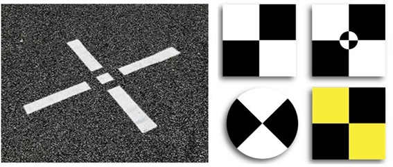
The use of unmanned aerial vehicles (UAVs) for aerial photography has become increasingly popular in various fields, including engineering, urban planning, environmental impact studies, and monitoring of transportation lines, power supplies, and other military applications. One of the main challenges in using drone imagery to model urban buildings is achieving high accuracy in generating 3D models. This paper focuses on improving the accuracy of urban building modelling using drone imagery, structure from motion, and multi-view stereo techniques used in computer vision, augmented virtual reality, geo-science, photography, and aerial photography to create 3D models from pairs of images. The study uses a UAV with a DJI Mavic 2 Pro drone 4K sophisticated camera for up to 31 minutes of flight time. Data collection time at different angles and specific heights while incorporating ground control points to enhance the accuracy of the generated point clouds. A specific location inside Al-Nahrain University was chosen as a fieldwork model, where the images captured by the drone were processed using Agisoft Metashape Pro software to create detailed 3D models for the buildings depending on the Structure form Motion (SfM) technique. The results demonstrate the efficient integration of Ground Control Points (GCP) combined with advanced processing techniques that enhance the model accuracy, achieving highly accurate GCP demonstrating error margins as low as 0.1% based on drone-derived data for urban buildings.
References
. A. Ulvi, "Documentation, Three-Dimensional (3D) Modelling and visualisation of cultural heritage by using Unmanned Aerial Vehicle (UAV) photogrammetry and terrestrial laser scanners," International Journal of Remote Sensing, vol. 42, no. 6, pp. 1994-2021, 2021.https://doi.org/ 10.1080/01431161.2020.1834164
. X. Wang, Z. Al-Shabbani, R. Sturgill, A. Kirk, and G. Dadi, "Estimating earthwork volumes through use of unmanned aerial systems," Transportation Research Record: Journal of the Transportation Research Board, vol. 2630, no. 1, pp. 1-8, 2017. https://doi.org/10.3141/2630-01
. S. P. Bemis, et al., "Ground-based and UAV-Based photogrammetry: A multi-scale, high-resolution mapping tool for structural geology and paleoseismology," Journal of Structural Geology, vol. 69, pp. 163-178, 2014.https://doi.org/10.1016/j.jsg.2014.10.007
. J. Liu and S. Ji, "A novel recurrent encoder-decoder structure for large-scale multi-view stereo reconstruction from an open aerial dataset," in Proceedings of the IEEE/CVF Conference on Computer Vision and Pattern Recognition, 2020.
. A. Kellaris et al., "Using low-cost drones to monitor heterogeneous submerged seaweed habitats: a case study in the Azores," Aquatic Conservation: Marine and Freshwater Ecosystems, vol. 29, no. 11,
. pp. 1909-1922, 2019. [Online]. Available: https://doi.org/10.1002/aqc.3189
. R. Alcarria, et al., "Analysing UAV-based remote sensing and WSN support for data fusion," in
. Proceedings of the International Conference on Information Technology & Systems (ICITS 2018),
. Springer International Publishing, 2018.https://doi.org/10.1007/978-3-319-73450-7_71
. S. Emard, "Time series of a forest canopy: detecting changes using the visible atmospherically resistant index and a low-cost drone," 2024. https://doi.org/10.32920/25169654
. W. Choi, S. Na, and S. Heo, "Integrating Drone Imagery and AI for Improved Construction Site Management through Building Information Modeling," Buildings, vol. 14, no. 4, p. 1106, 2024.https:// doi.org/10.3390/buildings14041106
. V. Bagnolo and N. Paba, "UAV-based photogrammetry for archaeological heritage site survey and 3D modeling of the sardus pater temple (Italy)," The International Archives of the Photogrammetry, Remote Sensing and Spatial Information Sciences, vol. 42, pp. 45-51, 2019.
. A. Ulvi, "Importance of unmanned aerial vehicles (UAVs) in the documentation of cultural heritage," Turkish Journal of Engineering, vol. 4, no. 3, pp. 104-112, 2020.https://doi.org/10.31127/ tuje.637050
. S. Jiang and W. Jiang, "UAV-based oblique photogrammetry for 3D reconstruction of transmission line: Practices and applications," The International Archives of the Photogrammetry, Remote Sensing and Spatial Information Sciences, vol. 42, pp. 401-406, 2019.https://doi.org/ 10.5194/isprs-archives-XLII-2-W13-401-2019
. R. C. Erenoglu, O. Erenoglu, and N. Arslan, "Accuracy assessment of low cost UAV based city modelling for urban planning," Tehnički vjesnik, vol. 25, no. 6, pp. 1708-1714, 2018.https://doi.org/ 10.17559/TV-20170904202055
. S. Gindraux, R. Boesch, and D. Farinotti, "Accuracy assessment of digital surface models from unmanned aerial vehicles' imagery on glaciers," Remote Sensing, vol. 9, no. 2, p. 186, 2017. https:// doi.org/10.3390/rs9020186
. B. E. Berrett, et al., "Large-scale reality modeling of a university campus using combined UAV and terrestrial photogrammetry for historical preservation and practical use," Drones, vol. 5, no. 4, p. 136, 2021.https://doi.org/10.3390/drones5040136
. S. Malihi, M. J. V. Zoej, and M. Hahn, "Large-scale accurate reconstruction of buildings employing point clouds generated from UAV imagery," Remote Sensing, vol. 10, no. 7, p. 1148, 2018.https://doi.org/10.3390/rs10071148
. F. Alidoost and H. Arefi, "An image-based technique for 3D building reconstruction using multi-view UAV images," The International Archives of the Photogrammetry, Remote Sensing and Spatial Information Sciences, vol. 40, pp. 43-46, 2015.
. E. Rublee, V. Rabaud, K. Konolige, and G. Bradski, "ORB: an efficient alternative to SIFT or SURF," in 2011 International Conference on Computer Vision, 2011. https://doi.org/10.1109/ iccv.2011.6126544
. U. Drešček, M. K. Fras, J. Tekavec, and A. Lisec, "Spatial ETL for 3D building modelling based on unmanned aerial vehicle data in semi-urban areas," Remote Sensing, vol. 12, no. 12, 2020, doi: 10.3390/rs12121972.https://doi.org/10.5194/isprsarchives-XL-1-W5-43-2015
. D. J. Backes and F. N. Teferle, "Multiscale Integration of High-Resolution Spaceborne and Drone-Based Imagery for a High-Accuracy Digital Elevation Model Over Tristan da Cunha," Frontiers in Earth Science, vol. 8, no. September,.https://doi.org/10.3389/feart.2020.00319
. R. G. Kippers, M. Koeva, M. Van Keulen, and S. J. Oude Elberink, "Automatic 3D building model generation using deep learning methods based on CityJSON and 2D floor plans," The International Archives of the Photogrammetry, Remote Sensing and Spatial Information Sciences - ISPRS Archives, vol.https://doi.org/10.5194/isprs-archives-XLVI-4-W4-2021-49-2021
. S. I. Deliry and U. Avdan, "Accuracy of Unmanned Aerial Systems Photogrammetry and Structure from Motion in Surveying and Mapping: A Review," Journal of the Indian Society of Remote Sensing, vol. 49, no. 8, pp. 1997–2017, 2021,https://doi.org/10.1007/s12524-021-01366-x
. M. Pepe, L. Fregonese, and N. Crocetto, "Use of SfM-MVS approach to nadir and oblique images generated through aerial cameras to build 2.5D map and 3D models in urban areas," Geocarto International, vol. 37, no. 1, pp. 120–141, 2022,https://doi.org/10.1080/10106049.2019.1700558
. X. Liu, X. Lian, W. Yang, F. Wang, Y. Han, and Y. Zhang, "Accuracy Assessment of a UAV Direct Georeferencing Method and Impact of the Configuration of Ground Control Points," Drones, https://doi.org/10.3390/drones6020030
. D. Wang and H. Shu, "Accuracy Analysis of Three-Dimensional Modeling of a Multi-Level UAV without Control Points," Buildings, vol. 12, no. 5, 2022,https://doi.org/10.3390/buildings12050592
. Q. Li, H. Huang, W. Yu, and S. Jiang, "Optimised Views Photogrammetry: Precision Analysis and a Large-Scale Case Study in Qingdao," IEEE Journal of Selected Topics in Applied Earth Observations and Remote Sensing, vol. 16, pp. 1144–1159, 2023, https://doi.org/10.1109/JSTARS.2022.3233359
. B. Szypuła, "Accuracy of UAV-based DEMs without ground control points," Geoinformatica, vol. 28, no. 1, pp. 1–28, 2024, https://doi.org/10.1007/s10707-023-00498-1
Downloads
Published
How to Cite
Issue
Section
License
Copyright (c) 2024 Adel Abdullah Jawad, M. N. Al-Turfi, Dheaa Sh. Al-Rubaie

This work is licensed under a Creative Commons Attribution-ShareAlike 4.0 International License.